

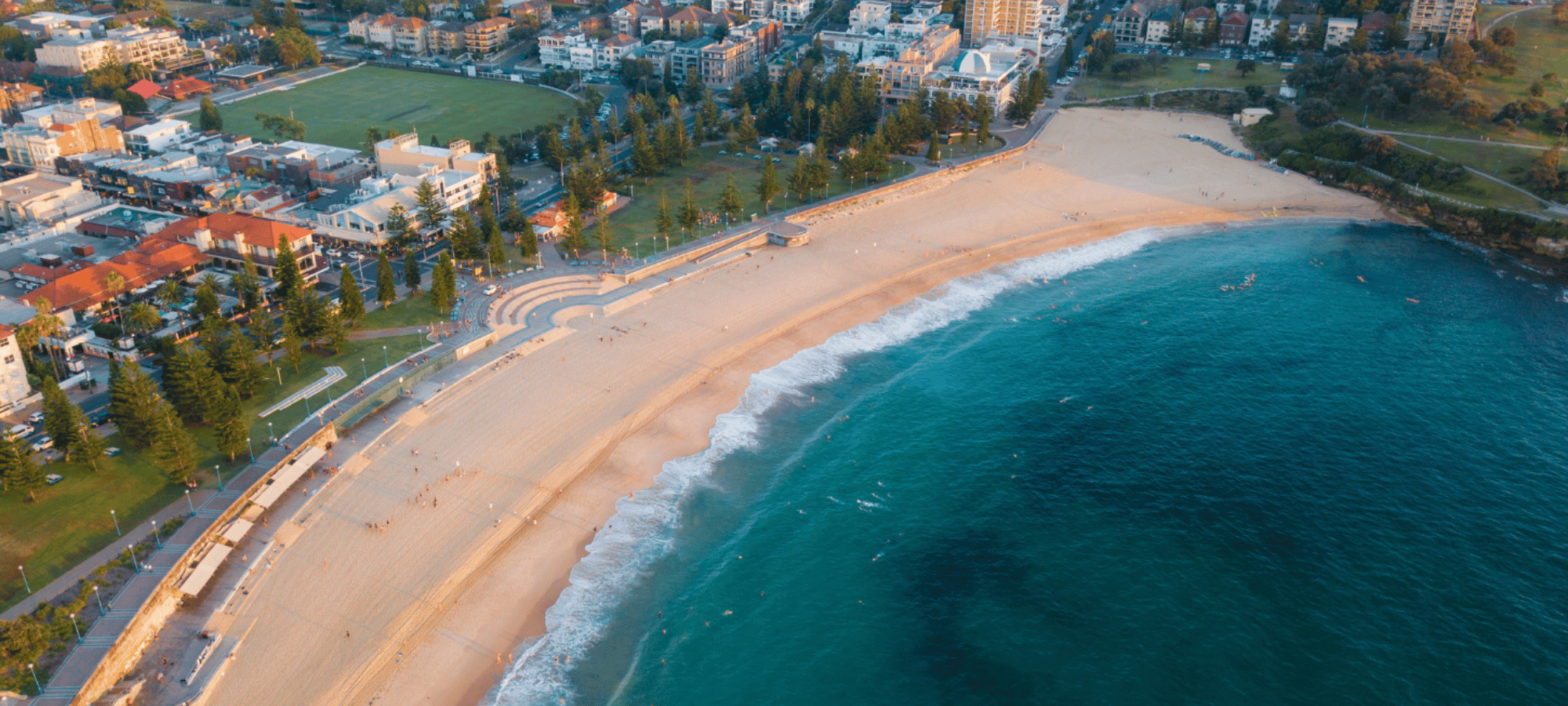
SYDNEY'S EASTERN BEACHES ROUTE MAP
ROUTE HIGHLIGHTS
Ready to explore Sydney’s most spectacular coastline? Choose a 20km, 30km or 50km Coastrek adventure – the longer you hike, the more you’ll see!
Starting just minutes from the CBD, you’ll discover breathtaking harbourside trails, national parks, hidden beaches, coastal tracks and some of Australia’s most iconic landmarks.
With Start Lines in Mosman, Rushcutters Bay and Vaucluse, and a Finish Line in Coogee, you’ll feel a world away from the city while taking in Sydney’s best views.

Date: 19 March 2027
Start: Vaucluse
Start time: From 11am
Finish: Coogee
Duration: Up to 6.5 Hours
*Actual distance: 20.5km

Date: 19 March 2027
Start: Rushcutters Bay
Start time: From 7:30am
Finish: Coogee
Duration: Up to 10 Hours
*Actual distance: 28.4km

Date: 19 March 2027
Start: Middle Head
Start time: From 6am
Finish: Coogee
Duration: Up to 15 Hours
*Actual distance: 49.9km
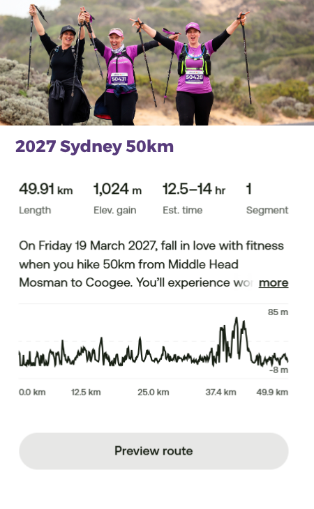
The intrepid 50km trekkers set off at dawn (6am) from Middle Head, Mosman, heading south along the track linking Middle Head and Georges Head. As the sun rises over Sydney, wind your way along a combination of bushwalking trails, including some stairs, with a low to medium incline reaching Bradleys Head. Tick off your first Sydney icon here as you pass Taronga Zoo, then continue undulating paved and natural pathways hugging the coastline around Cremorne Point and on to the North Sydney Luv Stop to recharge.
Leaving North Sydney, make your way up and over the Sydney Harbour Bridge, popping out at The Rocks – the historic heart of Sydney. Continue around the Sydney Opera House and Bennelong Point, following the water’s edge with Sydney Harbour on your left and the Royal Botanic Gardens on your right. Rounding Mrs Macquarie’s Chair, take a moment to look back at what you’ve already achieved, with uninterrupted views across to the headlands where you started this morning.
Continue through Sydney’s heritage neighbourhoods of Woolloomooloo and Elizabeth Bay on suburban street paths, before rolling into Rushcutters Bay for a well-earned rest (and maybe a stretch) at the Luv Stop.
As a 50km trekker, you’re one of the lucky few who get to experience this early morning stretch between Middle Head and Rushcutters Bay, watching Sydney Harbour wake up in all its glory – woohoo!
From Rushcutters Bay Park, you’ll clock up around 2km of suburban paths through Darling Point, Double Bay and Rose Bay (a chance to eye off the million-dollar real estate!). Next, link up with the famous Heritage Foreshore walk – past small remote harbourside beaches included Hermit Beach and Milk Beach – through to Nielson Park and the Vaucluse Luv Stop. After Vaucluse, the route winds around the Parsley Bay, where the picturesque Parsley Bay Suspension Bridge crosses the sparkling water below – you’ll swear you’ve landed in the Isle of Capri!
Keep going with a stunning loop around South Head and historic Hornby Lighthouse to Watsons Bay, where you’ll join the Coastal Cliff Walk – wild, rugged coastline and some of the most challenging inclines on the whole route.
From the Dover Heights Luv Stop, it’s mostly footpath and coastal trail from here, with just a touch of sand at Bondi, Tamarama, Bronte and Clovelly – the creme de la creme of Sydney’s east coast beaches!
With one final challenging push around Gordon’s Bay, it’s all downhill into the Coogee Finish Line. You did it – woohoo!
How much sand is on the 50km route?
Less than 2km of sand walking
Please note: All Coastrek routes are subject to change (thank you, nature!) and distances have a variance or +/- 3km*
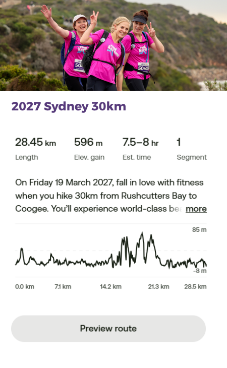
The 30km route kicks off at Rushcutters Bay Park, setting off at sunrise. You’ll clock up around 2km of suburban paths through Darling Point, Double Bay and Rose Bay (a chance to eye off the million-dollar real estate!). Next, link up with the famous Heritage Beach and Milk Beach – through to Nielsen Park and the Vaucluse Luv Stop.
After Vaucluse, the route winds around to Parsley Bay, where the picturesque Parsley Bay Suspension Bridge crosses the sparkling water below – you’ll swear you’ve landed in the Isle of Capri!
Keep going with a stunning loop around South Head and historic Hornby Lighthouse to Watsons Bay, where you’ll join the Coastal Clif Walk – wild, rugged coastline and some of the most challenging inclines on the whole route.
From the Dover Heights Luv Stop, it’s mostly footpath and coastal trail from here, with just a touch of sand at Bondi, Tamarama, Bronte and Clovelly – the creme de la creme of Sydney’s east coast beaches!
With one final challenging push around Gordons Bay, it’s all downhill into the Coogee Finish Line. You did it – woohoo!
How much sand is on the 30km route?
Less than 2km of sand walking
Please note: All Coastrek routes are subject to change (thank you, nature!) and distances have a variance or +/- 3km*
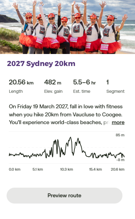
The 20km route kicks off at Vaucluse at 11am, winding around to Parsley Bay, where the picturesque Parsley Bay Suspension Bridge crosses the sparkling water – you’ll swear you’ve landed in the Isle of Capri!
Keep going with a stunning loop around South Head and historic Hornby Lighthouse to Watsons Bay, where you’ll join the Coastal Cliff Walk – wild, rugged coastline and some of the most challenging inclines on the whole route.
From the Dover Heights Luv Stop, its’ mostly footpath and coastal trail from here, with just a touch of sand at Bondi, Tamarama, Bronte and Clovelly – the creme de la dreme of Sydney’s east coast beaches!
With one final challenging push around Gordons Bay, it’s all downhill into the Coogee Finish Line. You did it – woohoo!
How much sand is on the 20km route?
Less than 1km of sand walking
Please note: All Coastrek routes are subject to change (thank you, nature!) and distances have a variance or +/- 3km*
Access Coastrek maps via AllTrails App
You can access the new Sydney 2027 route on your phone via the AllTrails App! First download the AllTrails App onto your phone via the App Store or Google Play, then click on the relevant Map links below to access the Coastrek route within the AllTrails App. The AllTrails App is FREE so you don't need to pay for it to access the map, just save it as a favourite :) But if you choose to get an AllTrails+ subscription, Coastrekkers get a one month free trial - see Goodie Bag in your Dashboard once you've signed up. With an AllTrails+ subscription, you can download the Coastrek route map and training trails for offline use (recommended!).
To save the Coastrek route as a 'favourite', click on the relevant event map link below via a desktop computer and click the ribbon icon in the top left corner. Then, open up your AllTrails app on your phone and click on the 'saved' menu item on the bottom of the screen. The route will appear there!
Click HERE for some easy to follow instructions on how to access the AllTrails map
Hard copy - Coastrek Sydney Map Guide
Wanting to keep it old school? We still have a hard copy map guide available as a simpler alternative to the All Trails maps.
Map GPX Files - Coastrek Sydney map GPX files
Want to download the map onto your smart watch or you have an existing map app that you'd prefer to use? This is an alternative you can download and install to your preferred device or app.
*MAP DISCLAIMER: All Coastrek routes are subject to change and distances have a variance or +/- 3km. Choose the distance challenge that’s right for you. It’s all part of the adventure and being immersed in nature! The Coastrek routes may also detour or change on Event Day due to unforeseen circumstances. We attempt, at all times, to adhere to the advised route however there may be circumstances beyond our control such as weather, tides, fallen trees/branches, or other safety aspects as advised by local councils that require us to alter the route. In any such cases these will be clearly marked and identified on Event Day, and communicated to trekkers beforehand where possible.

